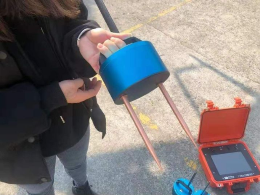
Water-detector, prospector, hole-detector, archaeometer, dyke leak detector, proton magnetometer
Array multichannel/multichannel measurement
Array magnetotelluric exploration instrument is an electrical measurement system that supports the synchronous data acquisition function of multiple electromagnetic sensors. It is wireless and distributed to keep the measurement and sampling of all sensors synchronized by means of GPS synchronization. Real-time synchronous data collection can greatly improve the accuracy, reliability and anti-interference ability of data collection.
1.10-inch large screen host, real-time imaging, the host directly display color and curve.
2.10-88 channel is optional, and the distance between points is 1-10 meters.
3. Real simultaneous measurement. Multiple data collectors are connected to the host through wireless communication.
4. Depth three gears can be switched freely.
5. Grading in a minute, results in a minute.
6. High-tech intelligent instrument, one person can operate.
7. Support remote firmware upgrade.

Array Wireless Multi-Channel Water Detector
The main purpose
1. It is widely used for detailed investigation and survey and exploration of underground natural energy sources such as groundwater and geothermal, so as to improve the success rate of water extraction by drilling.
2. It is widely used in the detailed survey and general survey and exploration of mineral energy (metallic, non-metallic, petroleum and natural gas, coal mine, etc.) to reduce the amount of geological drilling, reduce the risk of mining investment, and improve the scientific nature and success rate of mineral investment.
3. It is widely used for detailed investigation and reconnaissance exploration of hydrogeology, such as goaf of coal mine, groundwater disaster, hidden danger of dam, fault zone, collapse column and landslide, etc.
4. Determine the hidden location of the dam foundation of the reservoir and the flood control levee, search for fault zones and collapse columns, landslides, mined-out areas of coal mines, and search for geothermal and other hydrology and engineering geological exploration.
5. It is also used for engineering geological exploration of railways and Bridges, urban geophysical exploration, archaeological excavation, detailed survey and exploration of underground pipelines.